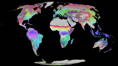
Painting the Earth
Coming into remote sensing, one of the aspects of geospatial analytics that is super important is learning how to read maps. Now I don’t mean learning how to read a traditional map of the world (although understanding the different projections Read More …